Independent Regional Intelligence
Yamuna ExpresswayPlots, Sectors & Maps
Research YEIDA plot categories, Sectors 18 and 20, master-plan maps, schemes and infrastructure—with practical checks before any property decision.
Published by Shubhlaabh Propmart Pvt. Ltd. · Independent guide · Not the official YEIDA website
92 Map Records13 Sector Guides5 Research Paths
Research ConsoleWhat Do You Want to Understand?
View Latest Updates Research PathsOne Region.
One Region.
Five Ways In.
Move from orientation to evidence without losing the context around a sector, scheme or project.
01Understand a SectorLand use, layouts and verification context.02Find a MapBrowse sectors, pockets, villages and regional plans.03Check a SchemeRead eligibility, dates and payment language.04Track InfrastructureSeparate operational status from proposals.05Understand a Public DocumentDecode plans, terms and source limits.
Regional ScaleThe Corridor,
The Corridor,
at Signal Level.
A quick view of the expressway scale, capacity and regional footprint.
165 kmAccess-controlled expressway connecting Greater Noida and Agra
6 lanesDesigned with capacity for future expansion to eight lanes
2001Year the regional development authority was constituted
6 districtsRegional planning footprint described by the authority
Map Explorer
Explore All 92 MapsSee the Region Spatially
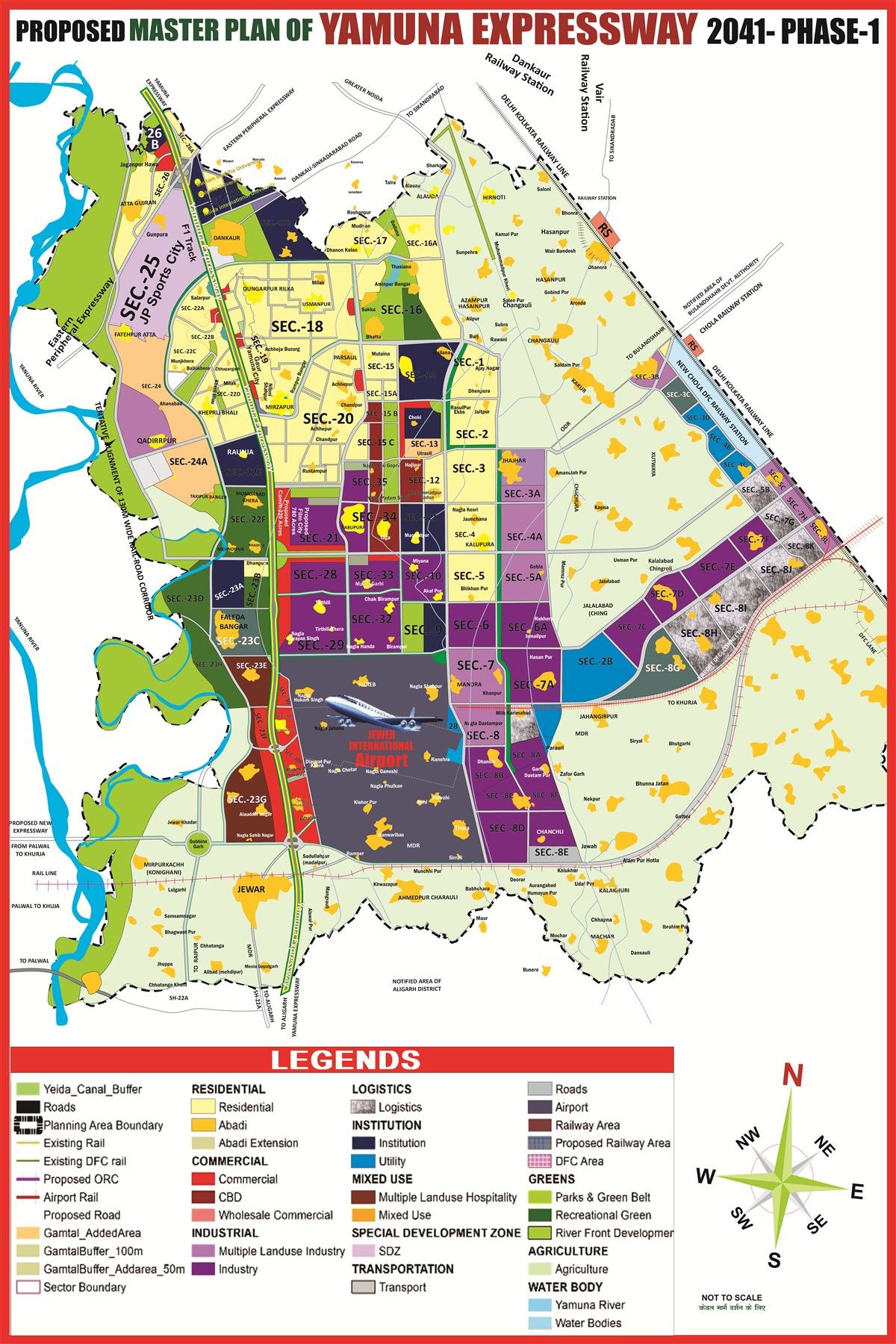
Browse the complete high-resolution collection of regional plans, sector layouts, pocket maps and village-abadi plans.
Sector Guides
Compare SectorsUnderstand Where Activity Is Taking Shape
Residential
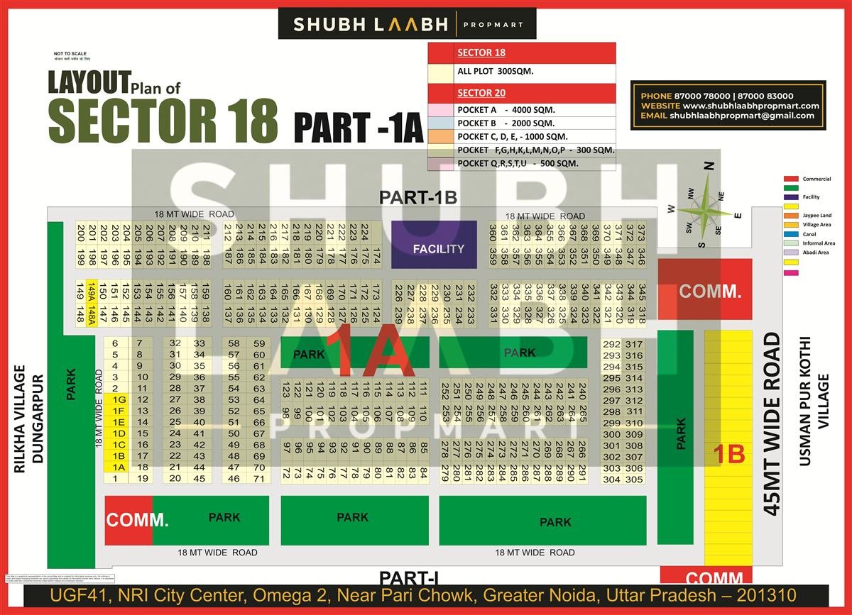
Sector 18
Historical scheme context, supplied layout records, verification steps and current-source limits.
Explore the SectorResidential
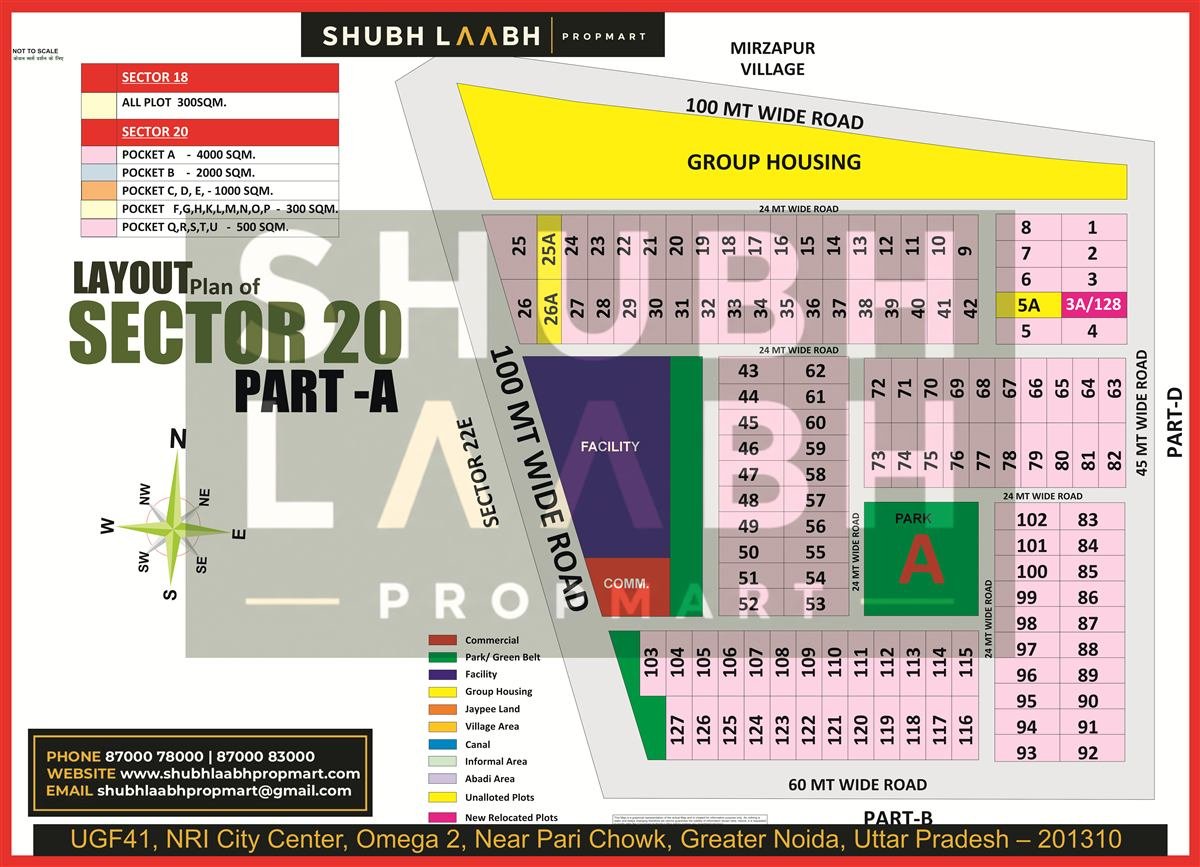
Sector 20
A structured guide to pocket maps, land-use reading and due-diligence questions.
Explore the SectorIndustrial
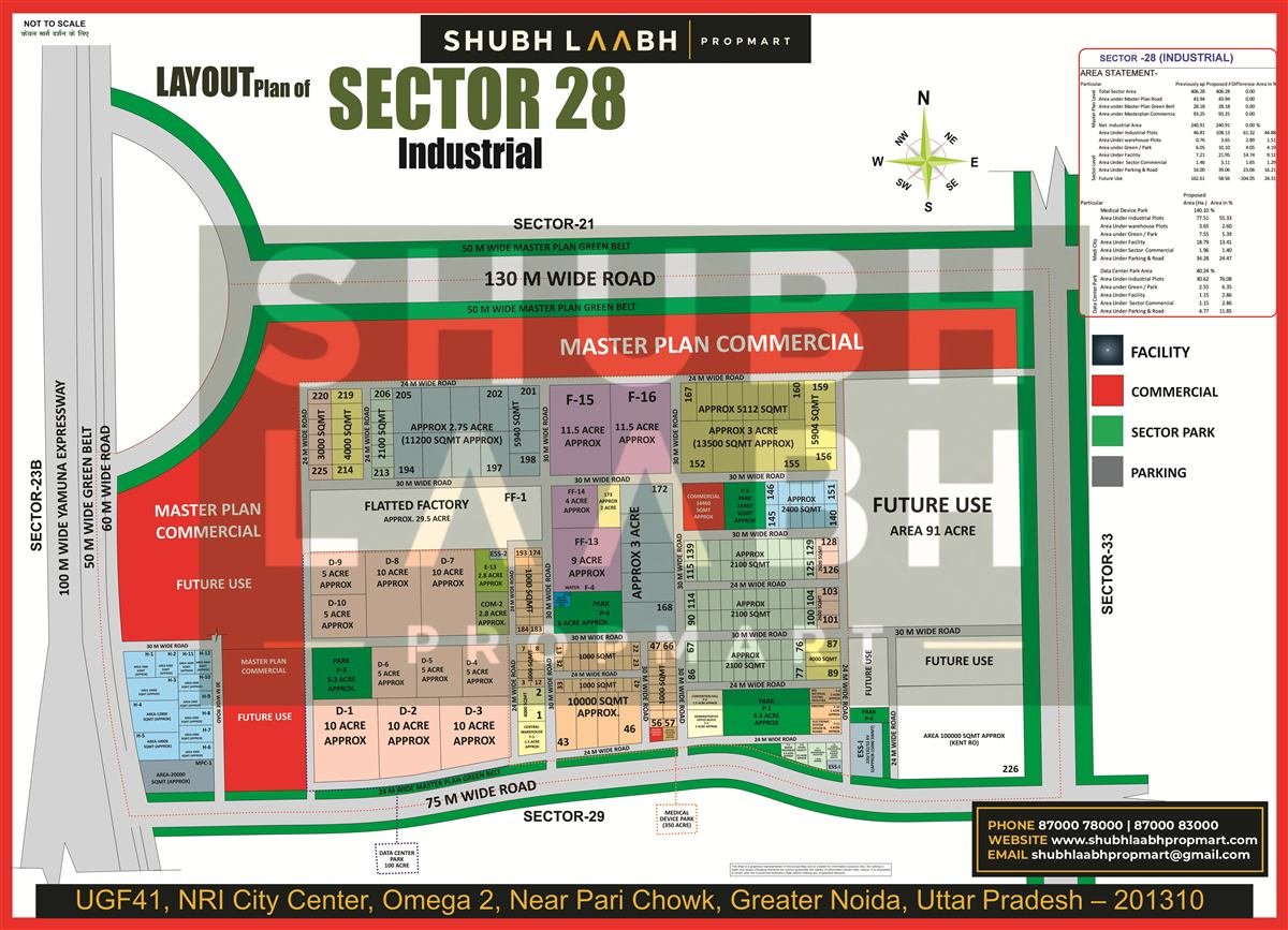
Sector 28
Official project context for the Medical Device Park and a supplied plan with clear caveats.
Explore the SectorInfrastructure TrackerMomentum,
Momentum,
Made Visible.
Track operating, under-development and proposed projects at a glance.
Noida International AirportOperational
The airport’s official website records first commercial flights on 15 June 2026.
↗Medical Device ParkUnder Development
Government and YEIDA sources describe a 350-acre project in Sector 28.
↗International Film CityApproved Framework
A 1,000-acre site is identified in Sector 21; implementation details remain source-dependent.
↗Ghaziabad–Jewar Namo BharatApproval Stage
NCRTC lists the corridor among projects in advanced stages of approval.
↗Regional Signals
All UpdatesWhat Changed, and What It Means
Commercial Flights Began at Noida International Airport
The airport operator reports that passenger operations started on 15 June 2026, initially with domestic routes.
Read AnalysisRPS10/2026 Has Completed Its Application and Draw Dates
The official brochure listed a 6 May closing date and an 18 June draw; a later payment office order was posted on 29 August.
Read AnalysisPhase-I Master Plan 2041 Material Is Available from YEIDA
The official page describes objectives and links to planning material. Check the document itself for draft or approval status.
Read AnalysisDocument DeskPlans and Guides.
Plans and Guides.
Made Usable.
Planning maps and concise explainers for quicker, better-informed decisions.
Sector Boundary Map · PDF
YEIDA Master Plan
2041Land use and sector layout
Archived Plan · PDF
Master Plan Phase-I
2031Land use and sector layout
Archived Plan · PDF
Master Plan Phase-I
2021Land use and sector layout
Read a Scheme Brochure
Eligibility · allotment · payments · terms · dates
Visual ExplainerDecode Land-Use Labels
Residential · industrial · mixed use
Still Have Questions?
Tell us what you are trying to understand. We will help you identify the relevant maps, public documents and reliable information—and clearly flag what still needs verification.